


Story and photos by Patricia Apelt (unless otherwise indicated)
Following The Wilderness Road
Beginning this drive where Interstate 64 meets and merges with Interstate 81 for almost fifty miles in south-central Virginia, we are just outside the town of Staunton, about three quarters of the way down toward the southern end of the Shenandoah Valley. Staunton (pronounced Stan-ton by native Virginians) is well known for its night life–music, theater, restaurants, etcetera. Home of The Statler Brothers quartet and The American Shakespeare Center at Blackfriers Theater, it is a story for another time—we only stopped here for lunch at The Golden Corral.
Walking back to our car was rather uncomfortable on this July day. Standing there with the doors open to let out the captured heat, we enjoyed looking at the surrounding countryside. With the The Blueridge Mountains to the East and the Allegheny range to the West, we could also see the beautiful Shenandoah Valley both North and South.
Climbing in and heading South, we enjoyed the air conditioning as we watched heat waves coming up off the pavement. Riding in a modern vehicle is not an overly uncomfortable experience. With the AC turned on, a soft seat and backrest, a cooler with bottles of water at my feet, and a bag of snacks on the seat beside me, it was rather nice. This was not always the case while traveling this same route.
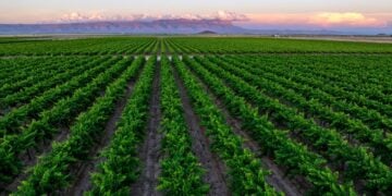
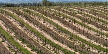
Looking over to my left, the heat waves appeared to get thicker and rise higher. I was gazing down toward Route 11, which runs parallel to I-81 for most of its length and is on the lowest part of the valley floor. My mind started wandering through the mist into the past.
Historians tell us that ‘buffalo’ or, to be more correct, Bison, roamed both The Shenandoah and New River valleys long before Native Americans. North American elk remains dated to 20,000 years ago have been documented in Virginia and were most common in the Allegheny and Blue Ridge mountains. Explorers in the late 1600s described abundant elk herds, particularly in the Shenandoah and New River valleys. It was the paths of the bison, elk, deer, bear, and lesser animals such as fox, wolves, and coyote that the Native Americans followed to form their own “roads”, and these were the trails that eventually became Route 11.
Early History
Native American tribes, following the Bison over the Bering Land Bridge, arrived in what is now Virginia at least 12,000 years ago. Tribes living in the Southwestern part of Virginia were mostly the Monacan, Cherokee, and Shawnee.The paths of the Bison and Elk were soon used by Native American tribes such as the Cherokee and Shawnee. They traveled over them to attack each other and called these paths the Athowominee, translated as “Path of the Armed Ones” or “The Great Warrior’s Path.”
After the Jamestown settlement in 1607, Europeans continued to emigrate to North America in vast numbers and soon became restless living on just the Eastern Seaboard. In 1775, the legendary frontiersman Daniel Boone blazed a trail through Big Stone Gap–a notch in the Appalachian Mountains located near the intersection of Kentucky, Virginia and Tennessee. Known as the Wilderness Road, the trail would serve as the pathway to the western United States for some 300,000 settlers over the next 35 years.
This ‘Wilderness Road’ followed what is now Route 11 from West Virginia, through Southwestern Virginia to a point just West of Big Stone Gap. The pioneers would travel from points north; Pennsylvania, New York, or Maine to join the migration to the West. Route 250 through Rockfish Gap at Afton Mountain brought early settlers from the East to meet Daniel Boone’s caravans along the animal trail “roads”.
Traveling by horseback or covered wagon, the trip was anything but comfortable. Food in the form of wild animals and birds was plentiful, and they could also find fruit and nuts depending on the season of the year, but the trip was hazardous and the trails were rough. Fording streams could be very dangerous, and there was always the chance of incountering war parties from the native tribes. However, many survived the trip, and moved on to Kentucky, Tennesee, and other areas further west.
Blacksburg
For our journey, the first stop was Blacksburg, Virginia. Now the home of Virginia Polytechnic Institute and State University (Virginia Tech), it was first called Drapers Meadow, named after the family who first settled there around 1750. Mary Draper Ingles was born in 1732. In 1750, Mary married fellow settler William Ingles (1729-1782). They had two sons: Thomas, born in 1751, and George, born in 1753. It was here at Drapers Meadow in July of 1755 (during the French and Indian War) that a band of Shawnee (paid by the French to do so) attacked the settlement, killed six settlers, including Mary’s mother and her infant niece.
They took five captives, including Mary and her two sons, her sister-in-law Bettie Robertson Draper, and her neighbor Henry Lenard (or Leonard). Mary’s husband was nearly killed but fled into the forest. The Indians took their captives, along with several horses loaded with items taken from the settlers’ homes, northwest along the New River, then along the Ohio River, traveling for a month to the main camp in southern Ohio. In late October 1755, Mary escaped with nothing but an old blanket and her courage. Remembering the river route while being taken to the Indian camp, Mary followed the same path going in the other direction. During the journey, she crossed at least 145 creeks and rivers—remarkable as she could not swim. When she came to a deep creek, she would have to walk upstream until it was narrow enough to cross, then return to the main river. She may have traveled as much as 1000 miles, averaging between eleven and twenty-one miles a day.

Approximately forty-two days after her escape, Mary stumbled into the yard of a friend and neighbor and was then reunited with her husband. They had four more children and she lived to be 83 years old. Mary’s complete story is documented in Follow The River, a book written by James Alexander Thom.
The photograph shows Mary Draper Ingles with her ragged blanket, a hatchet she had obtained by trading her shoes to the French, and a walking stick she cut several days into her return trip.
The New River valley where Mary Draper Ingles was captured is only a small section of this approximately 350-mile river. It is recognized as the “second oldest river in the world” and is estimated to be between 10 and 360 million years old. Its headwaters begin near Blowing Rock, NC and is one of the few rivers in North America that flows northerly. Different stories exist about the origin of the ancient river’s name. One story claims that the name comes from a translation from Indian dialect meaning “new waters.” Another tells of Captain Byrd who had been employed to open a road from the James River to Abingdon in 1764. Byrd used the Jefferson-Fry Map published in 1755, written by Joshua Fry and Peter Jefferson (father of Thomas Jefferson); this map did not show the river, so Byrd noted it as the “New River.”
Radford
The next stop on our trip along the Wilderness Road is Radford, Virginia. Housed in an 1870’s Victorian mansion there, The Glencoe Museum tells more of Mary Ingles, as well as showcasing artifacts from the Trigg site Indian village nearby and other local history.
Historians knew that the Native Americans had traveled through the area, but until 1971, they had no idea that any of the tribes had actually lived here. That is when the City of Radford began to convert cornfields purchased from the Trigg Family into a new city park on bottomland along the New River. After the work started, artifacts were found and officials soon realized they had a major discovery – the site had once been a Native American village.
Archaeologists excavated the 2.7-acre Trigg Site during the mid-1970s, discovering housing and burial grounds dating to the early part of the 17th century. They discovered evidence of the farming done there, with corn, squash, and beans (“the three sisters”) being the predominant crops. The dig produced more than 15 tons of artifacts, some of which are now housed at the Virginia Historical Society in Richmond and some at the Glencoe Museum.
Radford is also the location of Radford University, known in Virginia as being on the list of “Ranked Best Colleges And Universities In The South East”.
Abingdon

From Radford we move on to Abingdon, Virginia, where we find The Martha Washington Hotel and Spa, and just across the street, The Barter Theater. A legend in the history of Abingdon is that the town was named after Martha Washington’s ancestral home in England. Evidently the settlers in Abingdon had great admiration for the First Lady. Not only did they name their town but also their new college in honor of her.
Built in 1832, The Martha Washington Hotel and Spa began as the retirement home of General Francis Preston and Sarah Buchanan Preston and their nine children, at the cost of just under $15,000.
In 1858 the house was purchased for $21,000 in order for the mansion to become an upscale college for young women. The school was named Martha Washington College and is still affectionately called “The Martha” by locals. The college operated for over 70 years, through the Civil War and the Great Depression. During the Civil War, it served as a hospital for both sides, with some of the students acting as nurses. Several wings were added when it became a college for young ladies.
Born in 1905, Robert Porterfield grew up on a sheep farm in Saltville, just a few miles west of Abingdon. He left the farm and moved to New York City with the idea that he would become a famous actor on the stage. However, because of the Great Depression then gripping the country, no one could afford Broadway shows, so he could not find any work. He and his friends were starving and discouraged, so he came home. He noticed that the fall harvest was good and came up with a crazy idea. He invited his friends in N.Y. to join him, and they put on plays in exchange for food, thus starting The Barter Theater. If people could not afford 35¢ for a ticket, they could ‘barter’ their extra vegetables or animals to see a show. Now in its 87th year, The Barter Theater has become the longest running professional theater in the nation and has a long list of well-known actors who began their careers there—Gregory Peck, Patricia Neal, and Ernest Borgnine among many others. It is listed as the Official State Theater of Virginia.
Dining at The Tavern in Abingdon is a special treat. Built in 1779, it is the oldest of the historic buildings in town and one of the oldest bars west of the Blueridge. It is also haunted by a ‘Lady of the Night” who was murdered there. With a pleasant courtyard and delicious food, this is not to be missed.


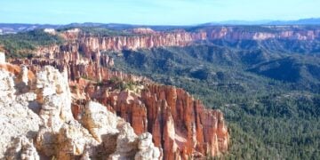
Big Stone Gap
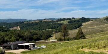
Leaving Abingdon on Route 58 we reach Big Stone Gap, one of Daniel Boone’s passes through the mountains on his trek to the West. Still following The Wilderness Road, it is much as he saw it many years ago. Long stretches of road with no buildings but lots of trees, with the road having just room to pass through mountains on either side are the norm. However, two things you will see that the pioneers did NOT are a great many patches of Queen Ann’s Lace and Chicory, usually growing together all along the roadside. These two plants are not native to the United States but are thought to have been brought here as seeds in the hay or grains the early settlers brought in to feed their livestock, or even as a human food item. The root of Queen Ann’s Lace can be used as a substitute for carrots and the plant is sometimes called Wild Carrot.
Chicory was cultivated as early as 5000 years ago by Egyptians as a medicinal plant. Ancient Greeks and Romans used chicory as a vegetable and in salads. The use of the wild foliage as an animal feed probably coincided closely with its first use as human food, which predated recorded history. The roots, roasted and ground, were used by early settlers as a substitute for coffee, as it had been in Europe for centuries.


The small town of Big Stone Gap is just that—a small town (pop. 5700). There are no attractions to draw in people except the beautiful scenery and two other notable exceptions. One would be the Southwest Virginia Museum Historical State Park showcasing the coal mining history of the area, and the other is The Trail of The Lonesome Pine outdoor drama. It is the Official State Outdoor Drama for Virginia and has been produced there in the June Tolliver theater since 1964.
The photograph below shows early morning fog over the valley just east of the notch in the Appalachian Mountains where Daniel Boone lead settlers so many years ago. It was taken from our Comfort Inn near the town of Big Stone Gap.

Bristol
From here, we traveled on to Bristol, Virginia. We had been delayed by a flat tire, so unfortunately, it was now Monday, and The Birthplace of Country Music Museum was closed. We did enjoy just walking and shopping along State Street. We had a wonderful lunch at Bloom (no ‘s’) — a “Café and Listening Room” on the Tennessee side of the street.
Since Bristol in on the Tennessee/Virginia border, small signs are embedded at each intersection with Virginia on one side and Tennessee on the other. The boundary line runs down the exact center of the street.
Time to load up our modern covered wagon and head back East.


