


Part Two: From Desert to Wildlife
Story and photos by Elsa Dixon (unless otherwise indicated)
Driving through the Namib Desert
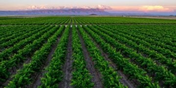
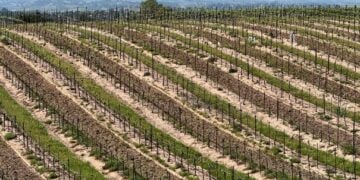
Leaving the blue waters of Walvis Bay, the flamingoes, and the coastal dunes behind, one immediately entered the desolate Namib Desert. Desert sands covered the surface of the tar road, nearly obliterating it. My first thought was, “Five hours driving on the C14 through the desert and the Namib-Naukluft National Park in these conditions?” However, the sand disappeared, the sun shone, and we passed through amazing moonlike landscapes, mountainous terrains, and miles of flat rocky plateaus. The incredible views compelled one to stop to take in the magnitude of Africa’s largest conservation area.
On leaving the more mountainous landscapes, stark, semi-desert plains opened up. Surprisingly, there were signs of wildlife. At intervals, a few mongooses popped out of a hole in the sand, a buck, warthog, and blouwildebeest nibbled on invisible morsels, while small herds of zebra and gemsbuck (oryx) grazed in the barren veld.

Tropic of Capricorn

A gathering of parked cars alerted us to the signboard’ Tropic of Capricorn’, one of the five major circles of latitude. The name refers to the Capricorn constellation rising above that circle on the summer solstice.
Solitaire

The next stop was Solitaire, the only gas station for 100 miles, and quite a quaint one at that! In between cactus plants, car skeletons filled the entire yard. There was a pile-up of cars and trucks at the few available pumps, but people waited amicably. Others met inside the convenience store, using the time to buy a meal or the legendary apple-pie at Moose McGregor’s Desert Bakery.
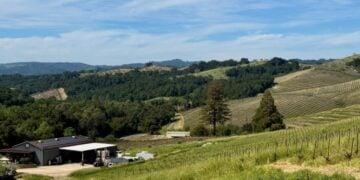
Namib Desert Lodge

There were quite a few guest lodges hidden on the vast, barren farms in this area. We stayed at the Namib Desert Lodge, another 30 minutes drive on a corrugated road that shook our insides.
A ridge of fossiled red dunes in the middle of a 62 square mile private reserve formed the backdrop for the Lodge. A series of ‘square-dawels’ neatly laid out along pathways led to the reception, a huge restaurant, swimming pool, and gift shop. A welcome gift, a small bottle of Namib sand on the pillow, added a nice touch.
Sossusvlei in the Namib-Naukluft Park

Sesriem is the gateway to Sossusvlei, where the dunes, among the highest in the world, can be found. It is a cluster of lodges, a gas station, and a small convenience store. For visitors staying outside the park, the gates open at sunrise and close at sunset. It is about a 30-minute drive at 37 miles per hour on an excellent tar road to reach the dunes. So, if you want to see the dunes’ magnificent red colors at sunrise, you will have to stay at either Sesriem Campsite or Sossus Dune Lodge inside the park. A second inner gate opens earlier before dawn and after dusk for these guests. Space is limited, so booking in advance is essential.
Dune 45
Dune 45, the most photographed dune in the world, gets its name from the 45 kilometers (30 miles) distance from the Sesriem Gate. A series of dunes of different hues line the road to get there. The five million-year-old sandhills owe their red color to the iron oxide content. The wind in this area blows from all directions, causing the sand to form star shapes, giving them their other name, ‘star dunes.’ At different times of the day, especially early morning and evening, the sun casts shadows over the dunes, and the colors keep changing. Shifting sands produce ripples and special effects, while long lines of footprints create different patterns.
It takes about an hour to climb Dune 45. From its 279 feet height, you can see the sheer expanse of Dune Valley. Remember: The sun is relentless, so take your hat, sunscreen, and water. Wear closed shoes to prevent the warm sand from burning your feet.


A Shuttle to the Deadvlei area

Unless you have a 4 X 4 and are proficient in driving in deep shifting sand, leave your vehicle at the designated parking area. Take the official 4X4 shuttle to reach Deadvlei, about 3 miles away.
I remained in the cool of one of the two trees while my friends set off to climb the 1066 feet high ‘Big Daddy’ dune, the tallest in the area. From the top, they viewed Deadvlei, a marsh famous for its petrified grey trees. The 900-year-old camel thorn trees cannot decompose because of the intense heat.
I requested our shuttle driver to take us on the short loop further to the Sossusvlei parking area, the end of the road. The name, Sossusvlei, is a combination of two Nama and Afrikaans words and means a ‘dead-end lake.’ Although Sossusvlei refers to the salt and clay pan at the end of the Tsauchab River, the name has come to include the whole area up to Dune 45.
We sat, admiring Big Mama, another famous dune to climb. A few green trees dotted the pan surrounding us. We circled back past the Deadvlei parking area and headed back to the car park. On the way, we stopped to help pull out a 4X4 that got stuck in the deep sand. As we drove slowly back to the gate, we gazed again in wonder at the sand dunes. In the late afternoon, they had turned to deep pink.
Fish River Canyon

The Fish River Canyon, the second largest Canyon globally, is located in the south of Namibia in the state-run Ais-Ais Richtersveld Transfrontier Park. The ravine is about 100 miles long, up to 47 miles wide, and almost 1805 feet deep in places.
The Park harbors at least 56 species of large mammals, including leopard, Hartmann’s mountain zebra, springbok, gemsbok, red hartebeest, kudu, klipspringer, gemsbok, steenbok, baboon, ostrich, ground squirrel, and suricate (a type of meerkat).
Visitors have to report at the Entrance to the Park situated 6 miles from the viewpoint Hell’s Bend at the Hobas Restcamp. Day visitors are not allowed to climb into the Canyon. Hikers can only attempt the Fish River Hiking Trail from April to September since the hike is closed in summer because of the heat.
Damara Village and Stall

After turning off the B2 on the D1918 towards Spitzkoppe between Usakos and Swakopmund, one comes across a small settlement of indigenous Damara people. They eke out a precarious living by selling their colorful crafts and semi-precious gemstones at individual stalls along the road and at the Uiba-Oas Crystal Market. The community created the market project about ten years ago. Translated, Uiba-Oas aptly means ‘seeking a livelihood.’ When tourists buy from these roadside curio shops, they get excellent value, and their money helps support the local people feed their families, or send a child to school.
We had an eye-opening experience when we looked for a basin at the solitary toilet facility at the market, accentuating how precious commodity water is in the desert. The local people had constructed a contraption whereby you pump a stick with your foot, activating a plastic container to tilt, spilling the water for washing your hands.
Spitzkoppe
The high outcrops of Spitzkoppe, surrounded by flat desert plains, are visible from quite afar. The literal translation of this German name is ‘sharply pointed heads.’ This group of granite formations is more than 120 million years old. The highest peak stands at about 2,200 feet. Driving amongst them, one is amazed at the odd boulders and formations. Spitzkoppe is a popular place for hikers and adventurers who try and climb the outcrops. There are chalets for overnight, as well as camping facilities.
A trivia fact: the movie producers for the ‘Dawn of Man’ sequences in 2001: A Space Odyssey used Spitzkoppe as the filming location.
Hidden in the rocks are examples of ancient Bushman (San) drawings. We booked a guide to take us on a short walking tour to such a site at the Entrance. Our escort was knowledgeable about the area as well, sharing information about local trees and animals.


Etosha National Park

The vast Etosha National Park is well worth a visit. Its distinguishing feature is the shimmering white and green salt pan covering nearly 1800 square miles, about a quarter of the whole Park’s surface. Etosha is the Ovambo word for ‘great white place.’ It is so large that one can see it from outer space.
Wildlife abounds on the salt pans, and one can easily see the animals since the plains are flat. It is thrilling to see animals like springbuck and zebra congregate in herds at the dams. We were also fortunate to see the unique black-faced impala. Four of the so-called Big Five reside in the Park: lion, elephant, leopard, and white and black rhino. Some camps have floodlit waterholes, making viewing even more exciting.
The Park is malaria-free and offers all facilities, restaurants, viewing decks, shops, gas stations, and a range of accommodation, including luxurious camps in the remote areas. The roads are in good condition and ideal for regular sedan cars.
Cheetah Conservation Fund – Research and Educational Centre

At the CCF, one sees first-hand how this international organization goes to work saving a species. CCF works closely with the local people and farmers in Namibia, educating people on safeguarding their livestock without harming the cheetahs. One can admire and learn more about the ’embassador’ cheetahs in their runs, ecosystems, and programs for co-existence with other species. It is fascinating to see how they train livestock guarding dogs on the premises at their Model Farm. The CCF develop best practices for wildlife and human populations to share their everyday world.
Guests can have a day-time visit or stay overnight. The CCF has comfortable accommodations and share homegrown and homemade foods with their visitors.
Ondekaremba Lodge near Hosea Kutako Airport – A Great Place to Stay
Ondekaremba Lodge, situated on a game farm, only a 10-minute-drive away from the airport, is an out-of-the-ordinary place to stay after arrival or before departure. It is a great way to unwind after a lengthy visit and road-tripping in Namibia. Since the Lodge is close to the airport, there is hardly any traffic and no rush to catch a plane.
We enjoyed the wildlife on the farm, especially seeing a large family of ground squirrels popping in and out from their boroughs under the ground. They looked exactly like meerkats.
The Lodge has a ‘teatime outside in a boma’ tradition, and a welcoming fire burning in the dining room at night. Meals are home-cooked with a good selection of excellent South African wines available.
The international airport, Hosea Kutako, is about 25 miles from Windhoek. Local flights are available to other major towns in the country. When making a road trip, advanced planning is essential. Although tar roads connect major places, the country is vast and desolate for the most part. Always inform your immediate family and the guest house or hotel where you will be traveling to and stay next. There are hardly any gas stations on the open roads, and there are long distances between places. Pack provisions, especially water, and a supply of food and snacks in case you get stranded. Make sure that there is a full spare tire, not just a donut. In any case, donuts are not a usual accessory for vehicles in Namibia or South Africa.
Namibia will welcome you back again!


Helpful Information and Links for Namibia

Gondwana Namib Desert Lodge
5.7 km West off C19, 9000 Solitaire, Namibia
Tel: +264 61 427 200
Fax: +264 61 251 863
After Hours: +264 81 129 2424
Direct bookings: bookings@gondwana-collection.com
Sossusvlei
Entry (Permit On Arrival)
There is a park entrance fee payable for each night you spend in the park or day visited. The cost is N$80 (US$6.50) per person and N$10 (US$0.80) per vehicle payable at the reception area inside the outer gate. If you’re heading out for sunrise, it’s best to buy your permit the day before.
4X4 shuttle in the park: N$170 per person
Note: Prices may be different after publication
Fish River Canyon
Spitzkoppe
http://www.spitzkoppe.com/
Etosha Game Park
Cheetah Conservation Fund – Research and Educational Centre
Otjiwarongo, Namibia
Ondekaremba Lodge
Address: B6, 7 km west from Hosea Kutako International Airport, Namibia
Phone: +264 62 540 424

